Software Helps Keep U.S. Ground Forces on the Move
The use of mobile devices is exploding for communications, entertainment, navigation, information collection and dissemination, and mobile health, to name just a few areas. Creare’s software team develops applications for iOS and Android that provide robust user-friendly interfaces for managing and interacting with data on cloud-based servers and for connecting and interacting directly with custom hardware. One important application for military planners is forecasting soil conditions.
Software for Cloud-Based Data Manipulation
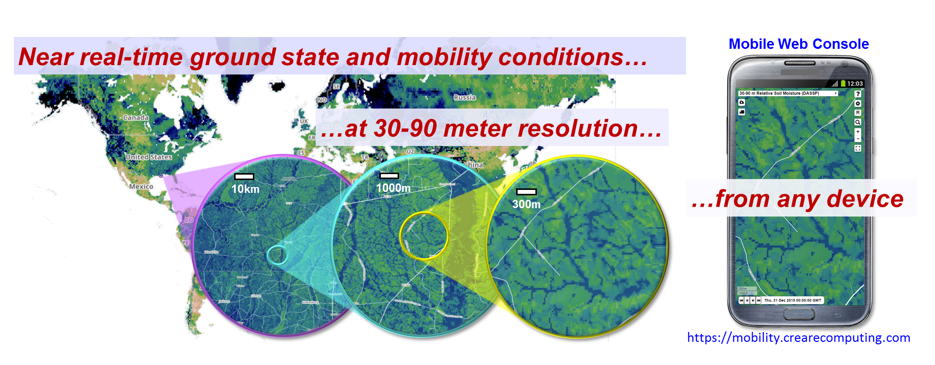
Weather and terrain conditions play a major role in the planning and execution of military maneuvers. Global terrain topography is relatively static and is known at high resolution (~30 m). However, terrain conditions such as soil moisture and soil strength can change rapidly due to weather and climate effects. Current global weather forecast predictions of these parameters are only available at very coarse resolution (~25 km).
Since terrain conditions can have a tremendous impact on mounted and dismounted force mobility, Creare is developing its GeoWATCH software to address the pressing need for forecasting of soil moisture and soil strength suitable for military-scale decision making (i.e., at spatial resolutions of meters instead of kilometers). To achieve this, GeoWATCH fuses data from low-resolution global weather forecasts with terabytes of global information regarding fine-resolution topography, vegetation, soil type, and land use. This enables GeoWATCH to generate high-resolution terrain condition forecasts at any global location in a fraction of a second.
Developing GeoWATCH requires a multidisciplinary technical approach that integrates Creare team expertise in geospatial data analysis, physics-based mass and energy transport modeling, soil hydrology, time-series statistical analyses, and software engineering. GeoWATCH is deployed using a highly efficient cloud-based computational architecture and open standards communication protocols for integration with vehicle-specific Army mobility models. This will enable soldiers in the field to access critical mobility information in a timely manner on very bandwidth-limited mobile devices.